
Ofbyld:Mexico map, MX-TAM.svg

Size of this PNG preview of this SVG file: 800 × 544 piksels. Oare resolúsjes: 320 × 218 piksels | 640 × 435 piksels | 1.024 × 696 piksels | 1.280 × 870 piksels | 2.560 × 1.741 piksels | 1.000 × 680 piksels.
Oarspronklik bestân (SVG-bestân, nominaal 1.000 × 680 pixels, bestânsgrutte: 267 KB)
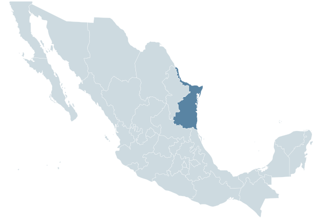
| Beskriuwing | Locator map for the state of Tamaulipas within Mexico. |
| Datum | 04-07-2007 |
| Boarne | Mexico States blank map.svg by Yavidaxiu and Sémhur |
| Auteur | Lokal_Profil |

|
Der wurdt tastimming jûn ta kopiearjen, fersprieden en/of wizigjen fan dit dokumint ûnder de betinksten fan de GNU-lisinsje foar iepen dokumintaasje, ferzje 1.2, as eltse lettere ferzje útjûn troch de Free Software Foundation; sûnder Ynfariante Seksjes, sûnder Omkaftteksten foar de Foarkante en sûnder Omkaftteksten foar de Efterkante. In kopy fan de lisinsje is opnaam yn de seksje "Text of the GNU Free Documentation License". |
| This file is licensed under the Creative Commons Attribution-Share Alike 3.0 Unported license. | ||
| ||
| This licensing tag was added to this file as part of the GFDL licensing update. |
Triemskiednis
Klik op in datum/tiid om it bestân te besjen sa't it op dat stuit wie.
| Datum/Tiid | Miniatuer | ôfmjittings | Meidogger | Opmerking | |
|---|---|---|---|---|---|
| lêste | 1 okt 2009, 03.57 | | 1.000 × 680 (267 KB) | Addicted04 | States borders |
| 19 nov 2007, 21.46 |  | 1.000 × 680 (123 KB) | El bart089 | updated version, based on map made by Lokal Profil. | |
| 4 jul 2007, 19.28 |  | 1.000 × 680 (117 KB) | Lokal Profil | {{Information |Description=Locator map for the state of Category:Tamaulipas within Mexico. |Source=Image:Mexico template.svg by Mario Fuente Cid <small>and Lokal_Profil</small> |Date=04-07-2007 |Author= |
Bestânsgebrûk
De neikommende side brûkt dit bestân:
Globaal bestânsgebrûk
De neikommende oare wiki's brûke dit bestân:
- Gebrûk op an.wikipedia.org
- Gebrûk op ay.wikipedia.org
- Gebrûk op azb.wikipedia.org
- Gebrûk op chy.wikipedia.org
- Gebrûk op en.wikipedia.org
- Gebrûk op en.wiktionary.org
- Gebrûk op es.wikipedia.org
- Gebrûk op fa.wikipedia.org
- Gebrûk op fr.wikipedia.org
- Gebrûk op hr.wikipedia.org
- Gebrûk op incubator.wikimedia.org
- Gebrûk op ka.wikipedia.org
- Gebrûk op lv.wikipedia.org
- Gebrûk op mr.wikipedia.org
- Gebrûk op nn.wikipedia.org
- Gebrûk op pl.wikipedia.org
- Gebrûk op ru.wikipedia.org
- Gebrûk op sco.wikipedia.org
- Gebrûk op sh.wikipedia.org
- Gebrûk op simple.wikipedia.org
- Gebrûk op sv.wikipedia.org
- Gebrûk op sw.wikipedia.org
- Gebrûk op th.wikipedia.org
- Gebrûk op uk.wikipedia.org
- Gebrûk op ur.wikipedia.org
- Gebrûk op uz.wikipedia.org
- Gebrûk op vi.wikipedia.org
- Gebrûk op zh.wiktionary.org