
Ofbyld:Map cuxhaven 1910.jpg

Oarspronklik bestân (576 × 816 pixels, bestânsgrutte: 366 KB, MIME-type: image/jpeg)
Gearfetting
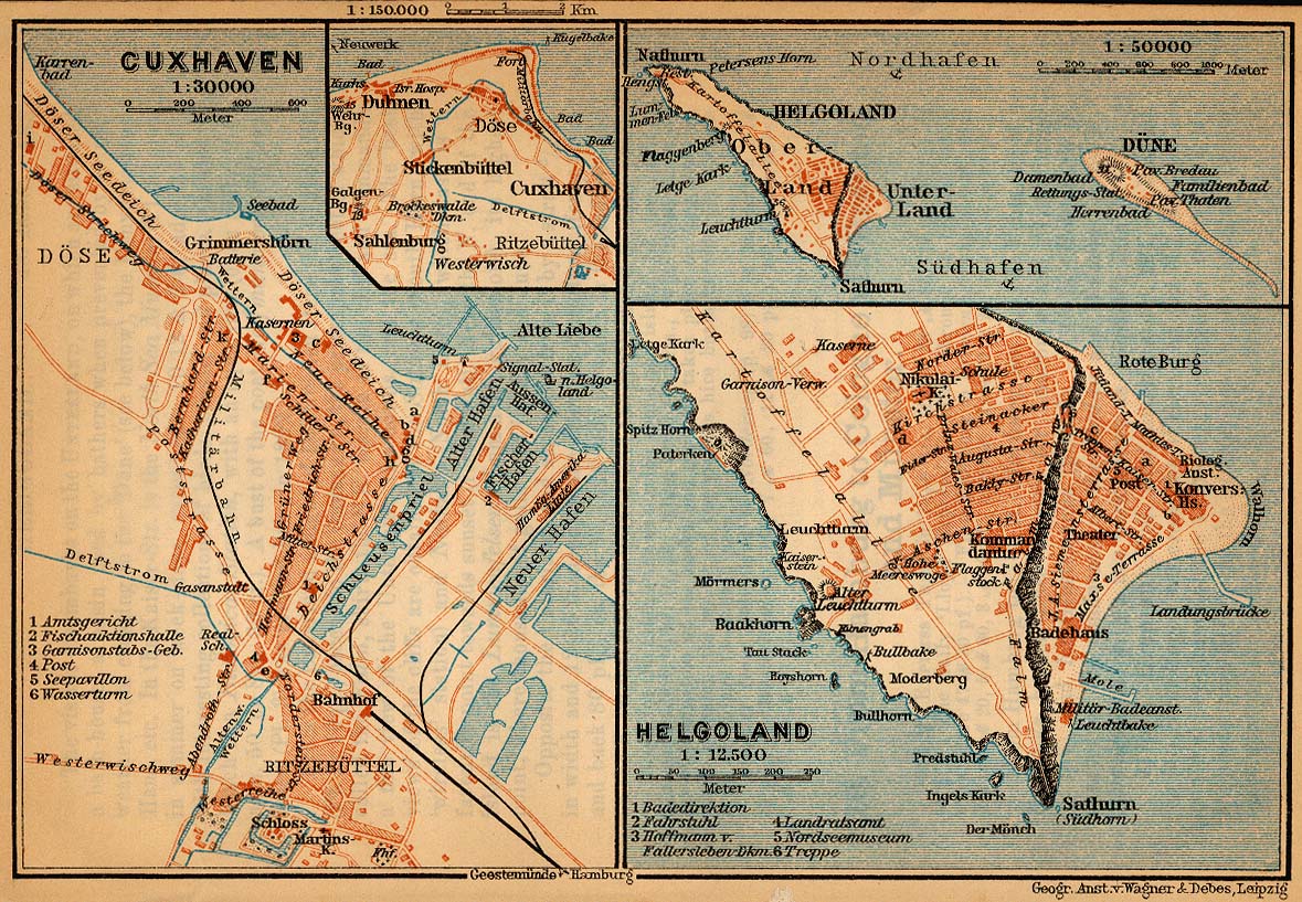
| Beskriuwing | Map of Cuxhaven, Germany, 1910 |
| Datum | |
| Boarne | http://www.lib.utexas.edu/maps/historical/baedeker_n_germany_1910/cuxhaven_helgoland_1910.jpg |
| Auteur | "Northern Germany as far as the Bavarian and Austrian Frontiers; Handbook for Travellers" by Karl Baedeker. Fifteenth Revised Edition. Leipzig, Karl Baedeker; New York, Charles Scribner's Sons 1910. |
| Tastimming (Reusing this file) |
"Courtesy of the University of Texas Libraries, The University of Texas at Austin." http://www.lib.utexas.edu/maps/map_sites/hist_sites.html |
| Oare ferzjes | cut from Image:Map cuxhaven helgoland 1910.jpg |
Lisinsje
|
This work is in the public domain in its country of origin and other countries and areas where the copyright term is the author's life plus 70 years or fewer.
| |
| This file has been identified as being free of known restrictions under copyright law, including all related and neighboring rights. | |
Triemskiednis
Klik op in datum/tiid om it bestân te besjen sa't it op dat stuit wie.
| Datum/Tiid | Miniatuer | ôfmjittings | Meidogger | Opmerking | |
|---|---|---|---|---|---|
| lêste | 25 apr 2006, 01.28 | | 576 × 816 (366 KB) | 700 MB | {{Information| |Description=Map of Cuxhaven, Germany, 1910 |Source=http://www.lib.utexas.edu/maps/historical/baedeker_n_germany_1910/cuxhaven_helgoland_1910.jpg |Date=1910 |Author="Northern Germany as far as the Bavarian and Austrian Frontiers; Handbook |
Bestânsgebrûk
De neikommende side brûkt dit bestân:
Globaal bestânsgebrûk
De neikommende oare wiki's brûke dit bestân:
- Gebrûk op ba.wikipedia.org
- Gebrûk op da.wikipedia.org
- Gebrûk op de.wikipedia.org
- Gebrûk op gl.wikipedia.org
- Gebrûk op hu.wikipedia.org
- Gebrûk op hy.wikipedia.org
- Gebrûk op ja.wikipedia.org
- Gebrûk op ru.wikipedia.org
- Gebrûk op uk.wikipedia.org