
Ofbyld:Map Gaels Brythons Picts GB.png
Gjin hegere resolúsje beskikber.
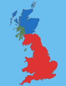
Map_Gaels_Brythons_Picts_GB.png (220 × 284 pixels, bestânsgrutte: 26 KB, MIME-type: image/png)
Gearfetting
| Beskriuwing |
English: Map Gaels Brythons Picts GB |
| Boarne | Eigen wurk |
| Auteur | malus36 |
Lisinsje
| This work is ineligible for copyright and therefore in the public domain because it consists entirely of information that is common property and contains no original authorship. |
Triemskiednis
Klik op in datum/tiid om it bestân te besjen sa't it op dat stuit wie.
| Datum/Tiid | Miniatuer | ôfmjittings | Meidogger | Opmerking | |
|---|---|---|---|---|---|
| lêste | 16 jan 2010, 16.17 | | 220 × 284 (26 KB) | Malus36 | {{Information |Description={{en|1=Map Gaels Brythons Picts GB}} |Source=own work |Author=malus36 |Date= |Permission= |other_versions= }} |
Bestânsgebrûk
De neikommende side brûkt dit bestân:
Globaal bestânsgebrûk
De neikommende oare wiki's brûke dit bestân:
- Gebrûk op ca.wikipedia.org
- Gebrûk op de.wikipedia.org
- Gebrûk op el.wikipedia.org
- Gebrûk op en.wikipedia.org
- Gebrûk op es.wikipedia.org
- Gebrûk op fa.wikipedia.org
- Gebrûk op fi.wikipedia.org
- Gebrûk op fr.wikipedia.org
- Gebrûk op hr.wikipedia.org
- Gebrûk op id.wikipedia.org
- Gebrûk op is.wikipedia.org
- Gebrûk op ka.wikipedia.org
- Gebrûk op ko.wikipedia.org
- Gebrûk op nl.wikipedia.org
- Gebrûk op pt.wikipedia.org
- Gebrûk op ro.wikipedia.org
- Gebrûk op sh.wikipedia.org
- Gebrûk op si.wikipedia.org
- Gebrûk op sl.wikipedia.org
- Gebrûk op ta.wikipedia.org
- Gebrûk op tr.wikipedia.org
- Gebrûk op uk.wikipedia.org
- Gebrûk op vi.wikipedia.org
- Gebrûk op www.wikidata.org
- Gebrûk op zh.wikipedia.org