
Ofbyld:Map - NL - Municipality code 0355 (2009).svg

Size of this PNG preview of this SVG file: 300 × 160 piksels. Oare resolúsjes: 320 × 171 piksels | 640 × 341 piksels | 1.024 × 546 piksels | 1.280 × 683 piksels | 2.560 × 1.365 piksels.
Oarspronklik bestân (SVG-bestân, nominaal 300 × 160 pixels, bestânsgrutte: 530 KB)
| Beskriuwing |
|
|||
| Datum | ||||
| Boarne | own work , using CBS data | |||
| Auteur | Michiel1972 (talk) 22:24, 24 January 2009 (UTC) | |||
| Tastimming (Reusing this file) |
Attribution ShareAlike 3.0 |

.svg)
This file is licensed under the Creative Commons Attribution-Share Alike 3.0 Unported license.
- Fiel jo frij:
- te dielen – it wurk te kopiearjen, fersprieden en út te stjoeren
- te fermingen – it wurk oan te passen
- Under de neikommende betingsten:
- Nammefermelding – You must give appropriate credit, provide a link to the license, and indicate if changes were made. You may do so in any reasonable manner, but not in any way that suggests the licensor endorses you or your use.
- Lyk diele – If you remix, transform, or build upon the material, you must distribute your contributions under the same or compatible license as the original.
Triemskiednis
Klik op in datum/tiid om it bestân te besjen sa't it op dat stuit wie.
| Datum/Tiid | Miniatuer | ôfmjittings | Meidogger | Opmerking | |
|---|---|---|---|---|---|
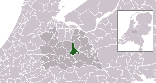
| lêste | 25 jan 2009, 00.24 | | 300 × 160 (530 KB) | Michiel1972 | {{Information |Description=*Location maps for the 441 municipalities in the Netherlands. Boundaries 1/1/2009 *Automatically generated with script *File name contains "Municipality code" (CBS-code) as specified in: [http://www.cbs.nl/nl-NL/menu/methoden/c |
Bestânsgebrûk
Der binne gjin siden dy't dit bestân brûke.
Globaal bestânsgebrûk
De neikommende oare wiki's brûke dit bestân:
- Gebrûk op af.wikipedia.org
- Gebrûk op ar.wikipedia.org
- Gebrûk op ca.wikipedia.org
- Gebrûk op en.wikipedia.org
- Gebrûk op eu.wikipedia.org
- Gebrûk op fa.wikipedia.org
- Gebrûk op fr.wikipedia.org
- Gebrûk op hu.wikipedia.org
- Gebrûk op hy.wikipedia.org
- Gebrûk op it.wikipedia.org
- Gebrûk op jv.wikipedia.org
- Gebrûk op la.wikipedia.org
- Gebrûk op mk.wikipedia.org
- Gebrûk op ms.wikipedia.org
- Gebrûk op nl.wikipedia.org
- Gebrûk op nn.wikipedia.org
- Gebrûk op ru.wikipedia.org
- Gebrûk op sco.wikipedia.org
- Gebrûk op stq.wikipedia.org
- Gebrûk op tr.wikipedia.org
- Gebrûk op uk.wikipedia.org
- Gebrûk op www.wikidata.org
- Gebrûk op zh.wikipedia.org
.svg)