
Ofbyld:Location map Rockall.jpg

Grutte fan dit proefbyld: 709 × 600 piksels. Oare resolúsjes: 284 × 240 piksels | 567 × 480 piksels | 908 × 768 piksels | 1.210 × 1.024 piksels | 1.300 × 1.100 piksels.
Oarspronklik bestân (1.300 × 1.100 pixels, bestânsgrutte: 857 KB, MIME-type: image/jpeg)
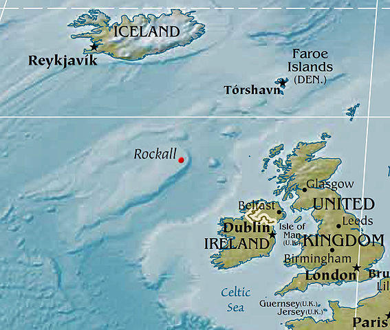
Map displaying the location of Rockall, based on a PD CIA world map. Political designations removed by Bjarki.
This image is in the public domain because it contains materials that originally came from the United States Central Intelligence Agency's World Factbook.
|
 |
Triemskiednis
Klik op in datum/tiid om it bestân te besjen sa't it op dat stuit wie.
| Datum/Tiid | Miniatuer | ôfmjittings | Meidogger | Opmerking | |
|---|---|---|---|---|---|
| lêste | 8 feb 2016, 04.02 | | 1.300 × 1.100 (857 KB) | Nagualdesign | Removed political designation ("UK"), since the area is disputed. |
| 28 des 2015, 07.32 |  | 1.300 × 1.100 (855 KB) | Nagualdesign | Updated (better resolution) using CIA map. | |
| 23 apr 2005, 15.34 |  | 615 × 520 (119 KB) | Bjarki S | Map displaying the location of Rockall, based on a PD CIA world map. Political designations removed by Bjarki. {{PD-USGov-CIA-WF}} |
Bestânsgebrûk
De neikommende side brûkt dit bestân:
Globaal bestânsgebrûk
De neikommende oare wiki's brûke dit bestân:
- Gebrûk op br.wikipedia.org
- Gebrûk op cs.wikipedia.org
- Gebrûk op de.wikipedia.org
- Gebrûk op en.wikipedia.org
- Gebrûk op eu.wikipedia.org
- Gebrûk op id.wikipedia.org
- Gebrûk op is.wikipedia.org
- Gebrûk op ko.wikipedia.org
- Gebrûk op nl.wikipedia.org
- Gebrûk op nn.wikipedia.org
- Gebrûk op pnb.wikipedia.org
- Gebrûk op sr.wikipedia.org
- Gebrûk op sv.wikipedia.org
- Gebrûk op tr.wikipedia.org
- Gebrûk op vi.wikipedia.org
- Gebrûk op www.wikidata.org