
Ofbyld:Illinois River aerial.jpg
Grutte fan dit proefbyld: 400 × 600 piksels. Oare resolúsjes: 160 × 240 piksels | 320 × 480 piksels | 512 × 768 piksels | 682 × 1.024 piksels | 1.365 × 2.048 piksels | 2.912 × 4.368 piksels.
Oarspronklik bestân (2.912 × 4.368 pixels, bestânsgrutte: 5,68 MB, MIME-type: image/jpeg)
Gearfetting
| Camera location | | View this and other nearby images on: OpenStreetMap |
|---|
| Beskriuwing |
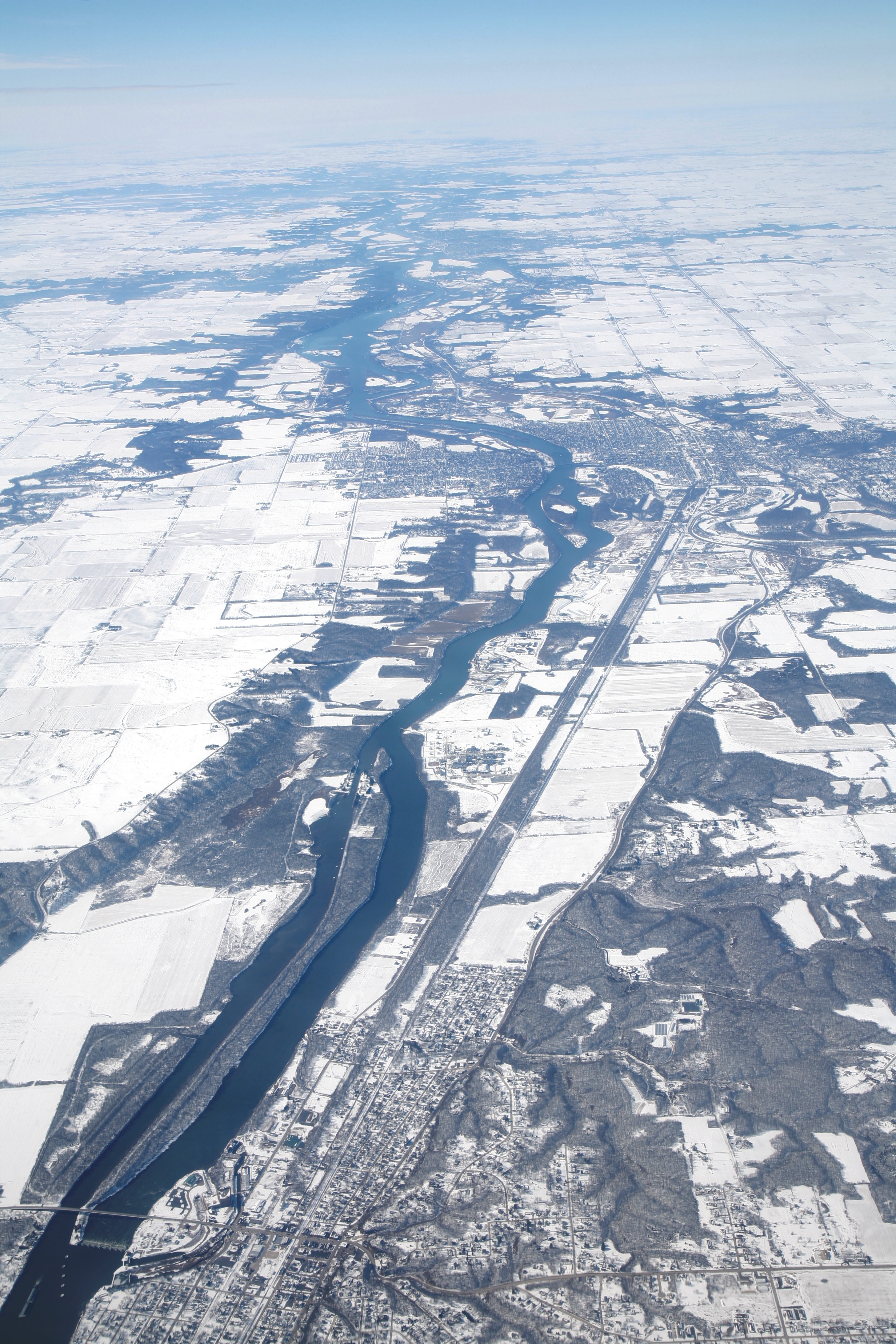
Deutsch: Luftbild des Illinois River zwischen Marseilles und Ottawa, Illinois |
| Datum | |
| Boarne | Eigen wurk |
| Auteur | Daniel Schwen |
Lisinsje
I, the copyright holder of this work, hereby publish it under the following license:
This file is licensed under the Creative Commons Attribution-Share Alike 4.0 International license.
- Fiel jo frij:
- te dielen – it wurk te kopiearjen, fersprieden en út te stjoeren
- te fermingen – it wurk oan te passen
- Under de neikommende betingsten:
- Nammefermelding – You must give appropriate credit, provide a link to the license, and indicate if changes were made. You may do so in any reasonable manner, but not in any way that suggests the licensor endorses you or your use.
- Lyk diele – If you remix, transform, or build upon the material, you must distribute your contributions under the same or compatible license as the original.
| Annotations | This image is annotated: View the annotations at Commons |
This image has been assessed using the Quality image guidelines and is considered a Quality image.
|
Triemskiednis
Klik op in datum/tiid om it bestân te besjen sa't it op dat stuit wie.
| Datum/Tiid | Miniatuer | ôfmjittings | Meidogger | Opmerking | |
|---|---|---|---|---|---|
| lêste | 26 feb 2010, 23.22 | | 2.912 × 4.368 (5,68 MB) | Dschwen | {{Information |Description={{de|Luftbild des Illinois River zwischen Marseille und Ottawa, Illinois}} {{en|Aerial image of the Illinois river between Marseille and Ottawa, Illinois.}} |Source={{own}} |Date= |Author=Daniel Schwen |Permissi |
Bestânsgebrûk
De neikommende side brûkt dit bestân:
Globaal bestânsgebrûk
De neikommende oare wiki's brûke dit bestân:
- Gebrûk op en.wikipedia.org
- Gebrûk op es.wikipedia.org
- Gebrûk op fr.wikipedia.org
- Gebrûk op ha.wikipedia.org
- Gebrûk op sl.wikipedia.org
- Gebrûk op uk.wikipedia.org