
Ofbyld:Huize Groenendaal bij Diepenveen -01.jpg

Grutte fan dit proefbyld: 800 × 600 piksels. Oare resolúsjes: 320 × 240 piksels | 640 × 480 piksels | 1.024 × 768 piksels | 1.280 × 960 piksels | 2.560 × 1.920 piksels | 4.288 × 3.216 piksels.
Oarspronklik bestân (4.288 × 3.216 pixels, bestânsgrutte: 2,89 MB, MIME-type: image/jpeg)
Gearfetting
| Beskriuwing |
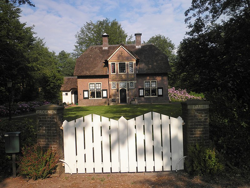
English: Groenendaal House, family house near Diepenveen, the Netherlands, built in 1909 after a design by Th. Rueter in Dutch "Arts and craft" style. Nationally listed heritage. Nederlands: Huize "Groenendaal": woonhuis bij Diepenveen in 1909 naar ontwerp van Theo Rueter gebouwd in Cottage-stijl. |
| Datum | |
| Boarne | Eigen wurk |
| Auteur | MarcoSwart |
|
This is an image of rijksmonument number 508976 Information from structured data: |
| Object location | | View this and other nearby images on: OpenStreetMap |
|---|
| Camera location | | View this and other nearby images on: OpenStreetMap |
|---|
Lisinsje
I, the copyright holder of this work, hereby publish it under the following license:
This file is licensed under the Creative Commons Attribution-Share Alike 3.0 Unported license.
- Fiel jo frij:
- te dielen – it wurk te kopiearjen, fersprieden en út te stjoeren
- te fermingen – it wurk oan te passen
- Under de neikommende betingsten:
- Nammefermelding – You must give appropriate credit, provide a link to the license, and indicate if changes were made. You may do so in any reasonable manner, but not in any way that suggests the licensor endorses you or your use.
- Lyk diele – If you remix, transform, or build upon the material, you must distribute your contributions under the same or compatible license as the original.
Triemskiednis
Klik op in datum/tiid om it bestân te besjen sa't it op dat stuit wie.
| Datum/Tiid | Miniatuer | ôfmjittings | Meidogger | Opmerking | |
|---|---|---|---|---|---|
| lêste | 29 mai 2011, 23.47 | | 4.288 × 3.216 (2,89 MB) | MarcoSwart |
Bestânsgebrûk
De neikommende side brûkt dit bestân:
Globaal bestânsgebrûk
De neikommende oare wiki's brûke dit bestân:
- Gebrûk op arz.wikipedia.org
- Gebrûk op nl.wikipedia.org
- Gebrûk op www.wikidata.org