
Ofbyld:Hampshire UK location map.svg

Size of this PNG preview of this SVG file: 704 × 599 piksels. Oare resolúsjes: 282 × 240 piksels | 564 × 480 piksels | 902 × 768 piksels | 1.203 × 1.024 piksels | 2.406 × 2.048 piksels | 1.425 × 1.213 piksels.
Oarspronklik bestân (SVG-bestân, nominaal 1.425 × 1.213 pixels, bestânsgrutte: 2,35 MB)
| Beskriuwing |
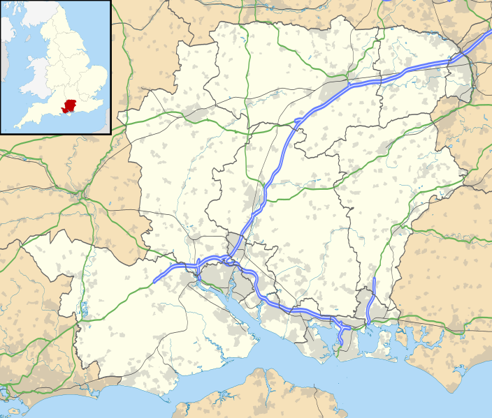
Map of Hampshire, UK with the following information shown:
Equirectangular map projection on WGS 84 datum, with N/S stretched 155% Geographic limits:
|
| Datum | |
| Boarne |
|
| Auteur | Nilfanion, created using Ordnance Survey data |
| Tastimming (Reusing this file) |
This file is licensed under the Creative Commons Attribution-Share Alike 3.0 Unported license. Nammefermelding: Contains Ordnance Survey data © Crown copyright and database right
|
| Oare ferzjes | File:Hampshire UK district map (blank).svg - Blank map |
.svg)
Triemskiednis
Klik op in datum/tiid om it bestân te besjen sa't it op dat stuit wie.
| Datum/Tiid | Miniatuer | ôfmjittings | Meidogger | Opmerking | |
|---|---|---|---|---|---|
| lêste | 26 sep 2010, 20.55 | | 1.425 × 1.213 (2,35 MB) | Nilfanion | {{Information |Description=Map of Hampshire, UK with the following information shown: *Administrative borders *Coastline, lakes and rivers *Roads and railways *Urban areas Equirectangular map projection on WGS 84 datum, with N/S stretched |
Bestânsgebrûk
De neikommende 2 siden brûke dit bestân:
Globaal bestânsgebrûk
De neikommende oare wiki's brûke dit bestân:
- Gebrûk op ar.wikipedia.org
- Gebrûk op bg.wikipedia.org
- Gebrûk op ceb.wikipedia.org
- Gebrûk op en.wikipedia.org
- Emsworth
- Hayling Island
- Hampshire
- Waterlooville
- Winchester
- Beaulieu, Hampshire
- Southsea
- Domus Dei
- Winchester Cathedral
- Romsey Abbey
- Calleva Atrebatum
- Tadley
- National Motor Museum, Beaulieu
- Wickham, Hampshire
- Romsey
- Little London, Tadley, Hampshire
- Lovedean
- Farnborough, Hampshire
- Fleet, Hampshire
- Church Crookham
- Blackbushe Airport
- Havant
- Nursling
- Fordingbridge
- Southampton Airport
- Fareham
- Whale Island, Hampshire
- Basingstoke
- Aldershot
- Eastleigh
- Alton, Hampshire
- Andover, Hampshire
- Lymington
- Portchester
- Ringwood, Hampshire
- Yateley
- Chawton
- New Milton
- Brockenhurst
- Bishop's Waltham
- Portchester Castle
- Hythe, Hampshire
- Portsea Island
- RAF Odiham
- University of Portsmouth
- Stratfield Saye House
Mear globaal gebrûk fan dit bestân besjen.