
Ofbyld:Gulf of Finland NLT Landsat7.png

Grutte fan dit proefbyld: 800 × 371 piksels. Oare resolúsjes: 320 × 148 piksels | 640 × 297 piksels | 1.024 × 475 piksels | 1.280 × 593 piksels | 2.500 × 1.159 piksels.
Oarspronklik bestân (2.500 × 1.159 pixels, bestânsgrutte: 4,79 MB, MIME-type: image/png)
Gearfetting
| Beskriuwing |
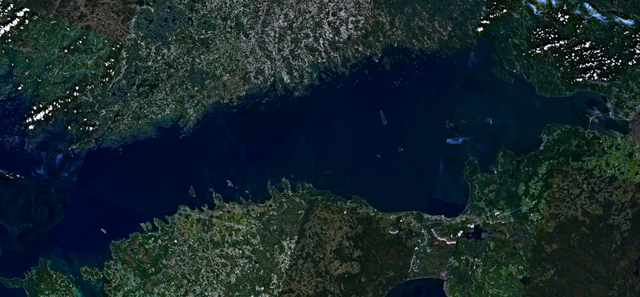
English: Visible colour satellite image of Gulf of Finland.
Русский: Финский залив.
Suomi: Suomenlahti.
Eesti: Soome laht.
Svenska: Finska viken.
Deutsch: Finnische Meerbusen. |
| Datum | 16 april 2006 (upload date) |
| Boarne | Satellite imagery taken from NASA World Wind software (by screenshot), NLT Landsat7 layer. |
| Auteur | NASA |
Lisinsje
| This image is in the public domain because it is a screenshot from NASA’s globe software World Wind using a public domain layer, such as Blue Marble, MODIS, Landsat, SRTM, USGS or GLOBE.
|
 |
Triemskiednis
Klik op in datum/tiid om it bestân te besjen sa't it op dat stuit wie.
| Datum/Tiid | Miniatuer | ôfmjittings | Meidogger | Opmerking | |
|---|---|---|---|---|---|
| lêste | 18 apr 2006, 18.41 | | 2.500 × 1.159 (4,79 MB) | Hautala | {{PD-WorldWind}} Visible colour satellite image of Gulf of Finland. Screenshot of NASA World Wind, NLT Landsat7 layer. Category:Satellite photos |
Bestânsgebrûk
De neikommende side brûkt dit bestân:
Globaal bestânsgebrûk
De neikommende oare wiki's brûke dit bestân:
- Gebrûk op ar.wikipedia.org
- Gebrûk op arz.wikipedia.org
- Gebrûk op ast.wikipedia.org
- Gebrûk op ba.wikipedia.org
- Gebrûk op be-tarask.wikipedia.org
- Gebrûk op br.wikipedia.org
- Gebrûk op ca.wikipedia.org
- Gebrûk op cy.wikipedia.org
- Gebrûk op da.wikipedia.org
- Gebrûk op eo.wikipedia.org
- Gebrûk op ga.wikipedia.org
- Gebrûk op he.wikipedia.org
- Gebrûk op hy.wikipedia.org
- Gebrûk op ms.wikipedia.org
- Gebrûk op mzn.wikipedia.org
- Gebrûk op no.wikipedia.org
- Gebrûk op pnb.wikipedia.org
- Gebrûk op pt.wikipedia.org
- Gebrûk op ro.wikipedia.org
- Gebrûk op ru.wikinews.org
- Gebrûk op www.wikidata.org