
Ofbyld:Corfu topographic map-en.svg

Oarspronklik bestân (SVG-bestân, nominaal 2.096 × 2.341 pixels, bestânsgrutte: 2,19 MB)
![]()
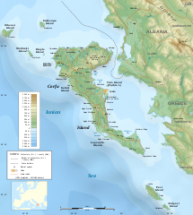
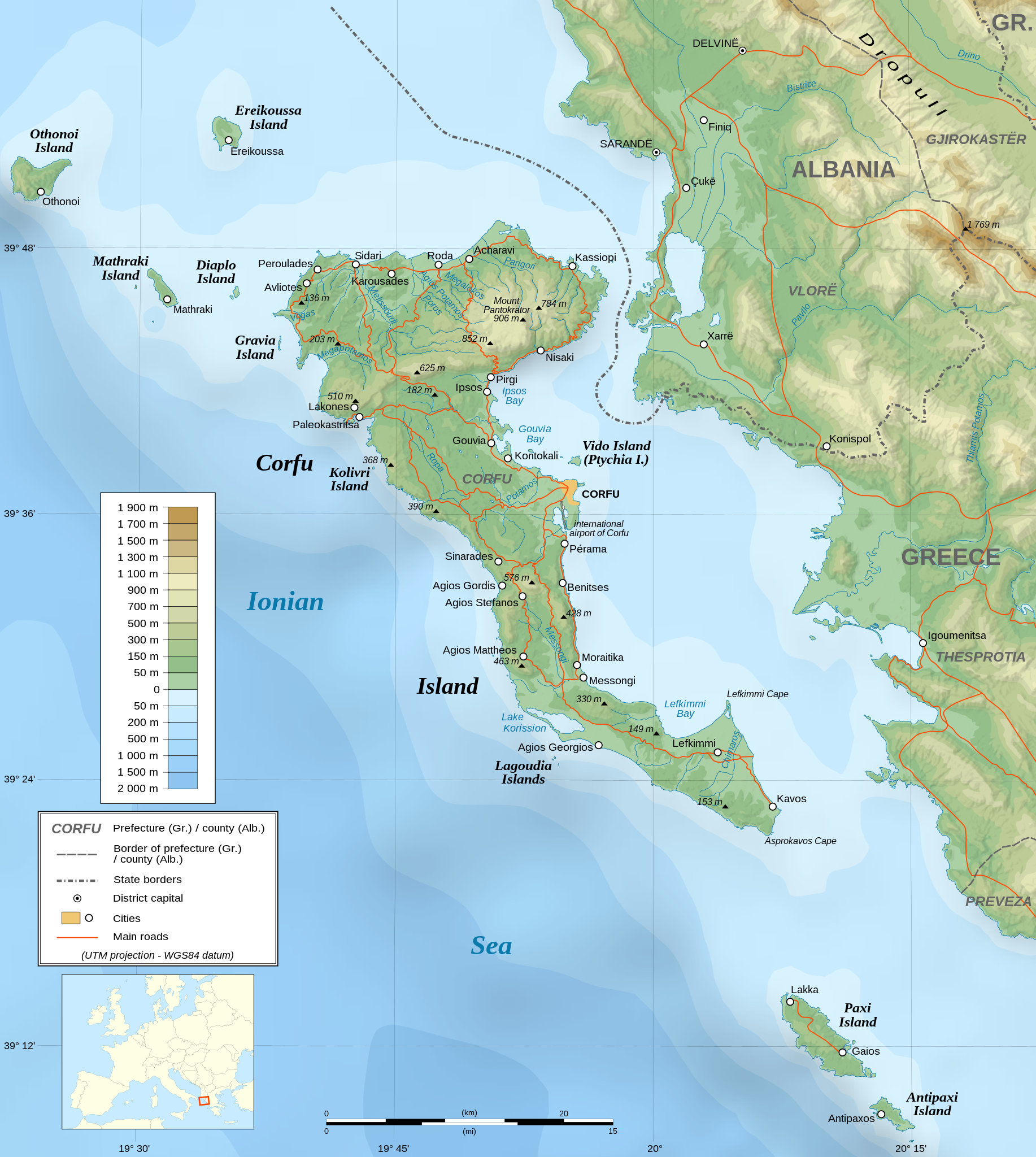
Detailed map of large dimension. For a better viewing, click on the link of the image above.
Carte détaillée de grande dimension. Pour une visualisation optimale, cliquer sur le lien de l'image ci-dessus.
Gearfetting
| Description |
English: Topographic map in English of the Corfu island area in Greece.
Note : The shaded relief is a raster image embedded in the SVG file. Français : Carte topographique en anglais de la zone de l'île de Corfou en Grèce.
Note : Le relief ombré est une image bitmap embarquée dans le fichier SVG. UTM projection ; WGS84 datum ; shaded relief (composite image of N-W, W and N lightning positions) ;
|
||
| SVG genesis | |||
| Datum | March 2007 (modified 09/2008) | ||
| Boarne |
Own work ;
|
||
| Makker | |||
| Tastimming (Reusing this file) |
|
||
| Georeferencing | If inappropriate please set warp_status = skip to hide. | ||
| Oare ferzjes |
[]
|


Lisinsje

|
Der wurdt tastimming jûn ta kopiearjen, fersprieden en/of wizigjen fan dit dokumint ûnder de betinksten fan de GNU-lisinsje foar iepen dokumintaasje, ferzje 1.2, as eltse lettere ferzje útjûn troch de Free Software Foundation; sûnder Ynfariante Seksjes, sûnder Omkaftteksten foar de Foarkante en sûnder Omkaftteksten foar de Efterkante. In kopy fan de lisinsje is opnaam yn de seksje "Text of the GNU Free Documentation License". |
| This file is licensed under the Creative Commons Attribution-Share Alike 3.0 Unported license. | ||
| ||
| This licensing tag was added to this file as part of the GFDL licensing update. |
- Fiel jo frij:
- te dielen – it wurk te kopiearjen, fersprieden en út te stjoeren
- te fermingen – it wurk oan te passen
- Under de neikommende betingsten:
- Nammefermelding – You must give appropriate credit, provide a link to the license, and indicate if changes were made. You may do so in any reasonable manner, but not in any way that suggests the licensor endorses you or your use.
- Lyk diele – If you remix, transform, or build upon the material, you must distribute your contributions under the same or compatible license as the original.
Assessment
|

Triemskiednis
Klik op in datum/tiid om it bestân te besjen sa't it op dat stuit wie.
| Datum/Tiid | Miniatuer | ôfmjittings | Meidogger | Opmerking | |
|---|---|---|---|---|---|
| lêste | 24 aug 2021, 09.17 | | 2.096 × 2.341 (2,19 MB) | Praça de Maio | File uploaded using svgtranslate tool (https://svgtranslate.toolforge.org/). Added translation for tr. |
| 30 okt 2014, 00.47 |  | 2.096 × 2.341 (2,18 MB) | Ras67 | cropped | |
| 5 sep 2008, 00.41 |  | 2.100 × 2.345 (2,47 MB) | Sting | Using bathymetry from ETOPO1 ; new standard colors | |
| 29 okt 2007, 20.59 |  | 2.100 × 2.345 (3,17 MB) | Sting | "Pavllo" river name correction ; + river names on Corfu island ; key more complete | |
| 16 mai 2007, 03.05 |  | 2.100 × 2.345 (3,14 MB) | Sting | International elevation key | |
| 30 mrt 2007, 03.07 |  | 2.100 × 2.345 (3,14 MB) | Sting | {{Information| |Description=Topographic map in French of the Corfu island area in Greece. |Source=Own work ;<br/>Background map : [http://www2.jpl.nasa.gov/srtm NASA Shuttle Radar Topography Mission] (SRTM3 v.2) (public domain) edited with [ |
Bestânsgebrûk
De neikommende 2 siden brûke dit bestân:
Globaal bestânsgebrûk
De neikommende oare wiki's brûke dit bestân:
- Gebrûk op af.wikipedia.org
- Gebrûk op bg.wikipedia.org
- Gebrûk op bn.wikipedia.org
- Gebrûk op bs.wikipedia.org
- Gebrûk op ca.wikipedia.org
- Gebrûk op de.wikipedia.org
- Gebrûk op en.wikipedia.org
- Gebrûk op es.wikipedia.org
- Gebrûk op fa.wikipedia.org
- Gebrûk op fi.wikipedia.org
- Gebrûk op fr.wikipedia.org
- Gebrûk op gl.wikipedia.org
- Gebrûk op he.wikipedia.org
- Gebrûk op hu.wikipedia.org
- Gebrûk op hy.wikipedia.org
- Gebrûk op ia.wikipedia.org
- Gebrûk op id.wikipedia.org
- Gebrûk op is.wikipedia.org
- Gebrûk op it.wikipedia.org
- Gebrûk op it.wikivoyage.org
- Gebrûk op ja.wikipedia.org
Mear globaal gebrûk fan dit bestân besjen.