
Ofbyld:CongoLualaba watershed topo.png
Grutte fan dit proefbyld: 721 × 599 piksels. Oare resolúsjes: 289 × 240 piksels | 578 × 480 piksels | 924 × 768 piksels | 1.150 × 956 piksels.
Oarspronklik bestân (1.150 × 956 pixels, bestânsgrutte: 768 KB, MIME-type: image/png)
Gearfetting
| Beskriuwing |
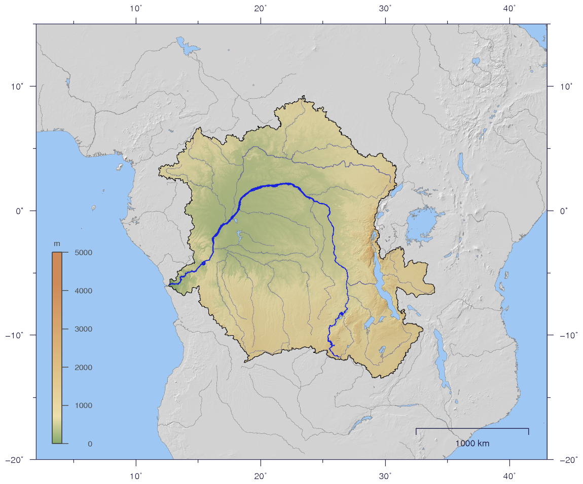
English: Course and Watershed of the Congo and Lualaba River with topography shading.
Deutsch: Verlauf und Einzugsgebiet von Kongo und Lualaba mit Reliefschattierung. |
| Datum | |
| Boarne | The map has been created with the Generic Mapping Tools: http://gmt.soest.hawaii.edu/ using additional public comain data from the VMAP0 data set. |
| Auteur | Imagico |
| Tastimming (Reusing this file) |
This file is licensed under the Creative Commons Attribution-Share Alike 2.5 Generic license.
|
| Oare ferzjes |
Derivative works of this file: Aruwimi-Ituri.png Image:CongoLualaba_watershed_plain.png |
Lisinsje
I, the copyright holder of this work, hereby publish it under the following license:
This file is licensed under the Creative Commons Attribution-Share Alike 2.5 Generic license.
- Fiel jo frij:
- te dielen – it wurk te kopiearjen, fersprieden en út te stjoeren
- te fermingen – it wurk oan te passen
- Under de neikommende betingsten:
- Nammefermelding – You must give appropriate credit, provide a link to the license, and indicate if changes were made. You may do so in any reasonable manner, but not in any way that suggests the licensor endorses you or your use.
- Lyk diele – If you remix, transform, or build upon the material, you must distribute your contributions under the same or compatible license as the original.
Triemskiednis
Klik op in datum/tiid om it bestân te besjen sa't it op dat stuit wie.
| Datum/Tiid | Miniatuer | ôfmjittings | Meidogger | Opmerking | |
|---|---|---|---|---|---|
| lêste | 2 jan 2007, 21.59 | | 1.150 × 956 (768 KB) | Imagico | {{Information |Description= {{en|Course and Watershed of the Congo and Lualaba River with topography shading.}} {{de|Verlauf und Einzugsgebiet von Kongo und Lualaba mit Reliefschattierung.}} |Source=The map has been created with the [[:en:Generic Mapping |
Bestânsgebrûk
De neikommende side brûkt dit bestân:
Globaal bestânsgebrûk
De neikommende oare wiki's brûke dit bestân:
- Gebrûk op af.wikipedia.org
- Gebrûk op als.wikipedia.org
- Gebrûk op ar.wikipedia.org
- Gebrûk op arz.wikipedia.org
- Gebrûk op as.wikipedia.org
- Gebrûk op az.wikipedia.org
- Gebrûk op ba.wikipedia.org
- Gebrûk op be.wikipedia.org
- Gebrûk op bg.wikipedia.org
- Gebrûk op bn.wikipedia.org
- Gebrûk op bo.wikipedia.org
- Gebrûk op br.wikipedia.org
- Gebrûk op ca.wikipedia.org
- Gebrûk op ceb.wikipedia.org
- Gebrûk op ckb.wikipedia.org
- Gebrûk op cs.wikipedia.org
- Gebrûk op da.wikipedia.org
- Gebrûk op de.wikipedia.org
- Gebrûk op dsb.wikipedia.org
- Gebrûk op en.wikipedia.org
- Gebrûk op en.wiktionary.org
- Gebrûk op eo.wikipedia.org
- Gebrûk op es.wikipedia.org
- Gebrûk op et.wikipedia.org
- Gebrûk op fi.wikipedia.org
- Gebrûk op fo.wikipedia.org
- Gebrûk op frr.wikipedia.org
- Gebrûk op fr.wikipedia.org
Mear globaal gebrûk fan dit bestân besjen.