
Ofbyld:Côte d'Ivoire Map.jpg
Grutte fan dit proefbyld: 470 × 600 piksels. Oare resolúsjes: 188 × 240 piksels | 376 × 480 piksels | 602 × 768 piksels | 1.036 × 1.322 piksels.
Oarspronklik bestân (1.036 × 1.322 pixels, bestânsgrutte: 440 KB, MIME-type: image/jpeg)
| Beskriuwing |
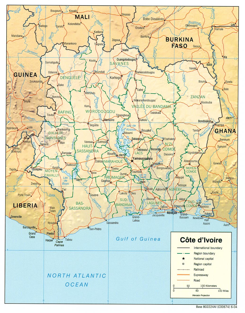
English: haded relief map of Côte d'Ivoire. |
|||
| Datum | ||||
| Boarne | [1] from the Perry-Castañeda Library Map Collection. | |||
| Auteur | CIA | |||
| Tastimming (Reusing this file) |
|

![[1]](http://www.lib.utexas.edu/maps/africa/cote_divoire_rel04.jpg)
Triemskiednis
Klik op in datum/tiid om it bestân te besjen sa't it op dat stuit wie.
| Datum/Tiid | Miniatuer | ôfmjittings | Meidogger | Opmerking | |
|---|---|---|---|---|---|
| lêste | 21 feb 2006, 13.11 | | 1.036 × 1.322 (440 KB) | Lupo | Shaded relief map of Côte d'Ivoire. Source: [http://www.lib.utexas.edu/maps/africa/cote_divoire_rel04.jpg] from the [http://www.lib.utexas.edu/maps/cote_d'ivoire.html Perry-Castañeda Library Map Collection]. {{PD-USGov-CIA}} [[Category:Maps of C� |
Bestânsgebrûk
De neikommende 2 siden brûke dit bestân:
Globaal bestânsgebrûk
De neikommende oare wiki's brûke dit bestân:
- Gebrûk op als.wikipedia.org
- Gebrûk op ar.wikipedia.org
- Gebrûk op az.wikipedia.org
- Gebrûk op be.wikipedia.org
- Gebrûk op bn.wikipedia.org
- Gebrûk op ca.wikipedia.org
- Gebrûk op ckb.wikipedia.org
- Gebrûk op cv.wikipedia.org
- Gebrûk op de.wikipedia.org
- Gebrûk op en.wikipedia.org
- Gebrûk op es.wikipedia.org
- Gebrûk op fa.wikipedia.org
- Gebrûk op fr.wikipedia.org
- Gebrûk op fr.wikinews.org
- Gebrûk op gd.wikipedia.org
- Gebrûk op gl.wikipedia.org
- Gebrûk op hi.wikipedia.org
- Gebrûk op id.wikipedia.org
- Gebrûk op it.wikipedia.org
- Gebrûk op ka.wikipedia.org
- Gebrûk op kbp.wikipedia.org
- Gebrûk op kk.wikipedia.org
- Gebrûk op lfn.wikipedia.org
- Gebrûk op ms.wikipedia.org
- Gebrûk op mzn.wikipedia.org
- Gebrûk op nl.wikipedia.org
- Gebrûk op pl.wikipedia.org
- Gebrûk op ru.wikipedia.org
Mear globaal gebrûk fan dit bestân besjen.