
Ofbyld:Africa-countries-northern.png
Gjin hegere resolúsje beskikber.
Africa-countries-northern.png (360 × 392 pixels, bestânsgrutte: 10 KB, MIME-type: image/png)

|
Ofbyld:Africa-countries-northern.svg is in fektorferzje fan dizze triem. As net fan sljochtere kwaliteit tsjinnet dizze brûkt te wurden yn plak fan dizze rasterôfbylding.
File:Africa-countries-northern.png → File:Africa-countries-northern.svg
Sjoch Help:SVG foar mear ynformaasje. |
 |
Gearfetting
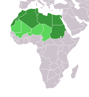
English: Map of countries in geo-political North Africa — as considered by the U.N.
- Credits
from en:Image:Africa-countries-northern.png

|
Der wurdt tastimming jûn ta kopiearjen, fersprieden en/of wizigjen fan dit dokumint ûnder de betinksten fan de GNU-lisinsje foar iepen dokumintaasje, ferzje 1.2, as eltse lettere ferzje útjûn troch de Free Software Foundation; sûnder Ynfariante Seksjes, sûnder Omkaftteksten foar de Foarkante en sûnder Omkaftteksten foar de Efterkante. In kopy fan de lisinsje is opnaam yn de seksje "Text of the GNU Free Documentation License". |
| This file is licensed under the Creative Commons Attribution-Share Alike 3.0 Unported license. | ||
| ||
| This licensing tag was added to this file as part of the GFDL licensing update. |
Triemskiednis
Klik op in datum/tiid om it bestân te besjen sa't it op dat stuit wie.
| Datum/Tiid | Miniatuer | ôfmjittings | Meidogger | Opmerking | |
|---|---|---|---|---|---|
| lêste | 17 mrt 2018, 17.22 | | 360 × 392 (10 KB) | Maphobbyist | Montenegro border |
| 31 mrt 2016, 23.00 |  | 360 × 392 (10 KB) | Fry1989 | Reverted to version as of 16:12, 13 January 2014 (UTC) | |
| 7 nov 2015, 11.37 |  | 360 × 392 (10 KB) | Hpyounes | correction | |
| 13 jan 2014, 18.12 |  | 360 × 392 (10 KB) | VVVF | See http://unstats.un.org/unsd/methods/m49/m49regin.htm | |
| 13 jan 2014, 17.59 |  | 360 × 392 (13 KB) | VVVF | Reverted to version as of 20:15, 9 July 2011. See http://unstats.un.org/unsd/methods/m49/m49regin.htm | |
| 20 jul 2011, 14.47 |  | 360 × 392 (7 KB) | Kahusi | See http://unstats.un.org/unsd/methods/m49/m49regin.htm | |
| 9 jul 2011, 22.15 |  | 360 × 392 (13 KB) | Maphobbyist | South Sudan has become independent on July 9, 2011. Sudan and South Sudan are shown with the new international border between them. | |
| 5 mai 2006, 13.13 |  | 360 × 392 (4 KB) | Hautala | optimized with png | |
| 20 apr 2005, 18.30 |  | 360 × 392 (14 KB) | Yonghokim | map of countries in Northern Africa. from en:Image:Africa-countries-northern.png {{GFDL}} |
Bestânsgebrûk
Der binne gjin siden dy't dit bestân brûke.
Globaal bestânsgebrûk
De neikommende oare wiki's brûke dit bestân:
- Gebrûk op ce.wikipedia.org
- Gebrûk op es.wikipedia.org
- Gebrûk op fr.wikipedia.org
- Gebrûk op he.wikipedia.org
- Gebrûk op ru.wikipedia.org
- Gebrûk op sc.wikipedia.org
- Gebrûk op sv.wikinews.org